|
Serving Business, Government, OEM, Education and the General Public since 1994
Your source for GPS, OEM GPS sensors, GPS Engine Boards, GPS Tracking,
GPS Antennas, Lidar-Lite, fleet telematics GPS, CB, Amateur and Marine Radios, Radio Scanners,
Fish Finders, Night Vision Optics, and much more!
|
|
|
|
|
|
|
|
Authorized Dealer for Garmin, USGlobalSat
|
|
|
|
|
  Garmin
GPS 18x-5Hz
high sensitivity WASS
enabled OEM GPS sensor for use in machine control,
guidance and agricultural applications that require 5 Hz
position and velocity reports. Small, highly
accurate GPS
receiver. Garmin
GPS 18x-5Hz
high sensitivity WASS
enabled OEM GPS sensor for use in machine control,
guidance and agricultural applications that require 5 Hz
position and velocity reports. Small, highly
accurate GPS
receiver. |
 BU353-S4
USGlobalSat USB GPS receiver highly
sensitive, low power consumption chipset in a ultra
compact form factor. Powered by a SiRF Star IV GPS
chipset. Superior performance in urban canyons,
dense foliage. BU353-S4
USGlobalSat USB GPS receiver highly
sensitive, low power consumption chipset in a ultra
compact form factor. Powered by a SiRF Star IV GPS
chipset. Superior performance in urban canyons,
dense foliage.
|
 GB-580P GPS Bike computer
by USGlobalSat. Slim sports
watch profile. High performance GPS chipset, high
resolution display with e-ink-like qualities under
sunlight, a "Trainer Mode",
GB-580P GPS Bike computer
by USGlobalSat. Slim sports
watch profile. High performance GPS chipset, high
resolution display with e-ink-like qualities under
sunlight, a "Trainer Mode",
|

GPS 16xLVS
Garmin GPS
sensor features a high-sensitivity receiver, integrated antenna and rugged,
waterproof
design that makes it useful for a variety of
OEM applications. |
 eXact Precision NV Scope Kit
2.6 x 44 eXact Precision night vision Scope can be used for multitude of applications including paintball, security surveillance or as a handheld monocular eXact Precision NV Scope Kit
2.6 x 44 eXact Precision night vision Scope can be used for multitude of applications including paintball, security surveillance or as a handheld monocular
|
 Holzberg PX-555U
Compact Professional Portable UHF Two-Way Radio FM
Transceiver. 450 to 470MHz, 4 W, 16-chsnls.
|
 NONM3XG
- Night Owl Optics NexGen 3x Night Vision Scope. 500x Ambient light amplification, powerful Infrared Illumination, NONM3XG
- Night Owl Optics NexGen 3x Night Vision Scope. 500x Ambient light amplification, powerful Infrared Illumination,
|
 |
|
|
|
|
No Longer Available
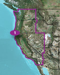
TOPO U.S. 24K West DVD (Garmin)
|
|
|
ID # 010-11314-00
|
Features:
- Includes topographic coverage of Washington, Oregon,
California and Nevada.
- Provides detailed digital topographic maps, comparable to
1:24,000 scale USGS maps.
- Contains detailed hydrographic features, including
coastlines, lake and river shorelines, wetlands and perennial and
seasonal streams.
- Allows you to search by points of interest, including
cities, summits, lakes, campsites and more.
- Provides elevation profile on compatible Garmin devices so
you can estimate terrain difficulty.
- Contains many routable trails, rural roads, city
neighborhood roads, major highways and interstates.
- Displays national, state and local parks, forests,
conservation areas and wilderness areas.
- Includes points of interests such as parks, campgrounds,
scenic lookouts and picnic sites.
- Displays Bureau of Land Management township, range and
section information and USGS quad locations
- Includes BaseCampTM software for
managing data on GPS and
computer, playing back
routes and tracks, geotagging photos and more
Compatible Garmin Products:
|
|
|
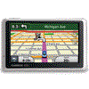
nüvi® 205W
|
nüvi® 765T
|
|
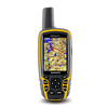
Colorado® 400t
|
|
|
nüvi® 770
|
|
|
|
|
nüvi® 775T
|
|
|
|
|
nüvi® 780
|
|
|
|
nüvi® 260
|
nüvi® 855
|
|
|
|
|
nüvi® 880
|
|
|
|
nüvi® 270
|
|
|
|
|
|
|
|
|
|
nüvi® 350
|
|
|
|
|
nüvi® 360
|
|
|
|
|
|
|
|
|
|
|
|
|
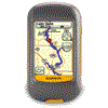
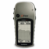
GPSMAP® 296
Aviation GPS -
Not Available
|
|
|
|
|
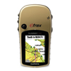
GPSMAP® 376C
|
|
|
|
|
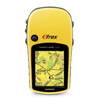
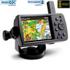
GPSMAP® 396
Aviation GPS -
Not Available
|
|
|
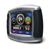
StreetPilot® c340
|
|
|
|
nüvi® 5000
|
|
|
|
|
|
zūmo® 450
|
|
|
|
nüvi® 660
|
|
|
|
|
nüvi® 755T
|
|
|
|
nüvi® 205
|
nüvi® 760
|
zūmo® 665
|
Not all features of this map will work
with nüvi® devices. See our FAQ for details.
About Coverage
Includes coverage for Washington, Oregon, California and
Nevada.
Click to view an interactive map:
Requirements:
You cannot use this product to update the maps on your
preloaded Garmin device. To order updated map data for your preloaded
Garmin device, visit the Garmin Update Maps page.
Minimum System Requirements
Internet access is required. Includes USB device drivers.
PC
- Windows® XP SP2 or newer
- 1 GB RAM
- at least 1024 x 768 display
- 24-bit color monitor
- 2 GB free disk space
- USB port
- DVD drive
Mac®
- Any Intel-based Mac® or PowerPC G4 or later Mac
- 1 GB RAM
- OS X 10.4 or later
- 1024 x 768 display
- 2 GB free disk space
- USB port
- DVD drive
|
Specifications, price and availability are subject to change without notice.
Gross Weight: 1 lbs.
|
|
|
|